

While studying geology at Northern Arizona University in the late 1970s, I came across some photos of the Italian Dolomites. To say that a few photos were amazing doesn’t do it justice. I vowed to go there someday. And a few months after I met Helen Thompson in 2005, she casually asked me if there was anywhere I wanted to go someday. That fantasy slot machine “wheel” spun in my head for a while, passing by Milford Sound in New Zealand, Perth in Australia, and the Karoo region of South Africa, before finally settling on the Dolomites. So I blurted out to her, “The Italian Dolomites!” She never forgot, and 18 years later, she made my dream come true.
It would probably take several posts to summarise the length and breadth of this trip. The scenery, nature, geology, culture and cuisine were all incredible, and I hope to give a taste of each in this and future posts.
 |
| Location of the Dolomites in northeastern Italy |
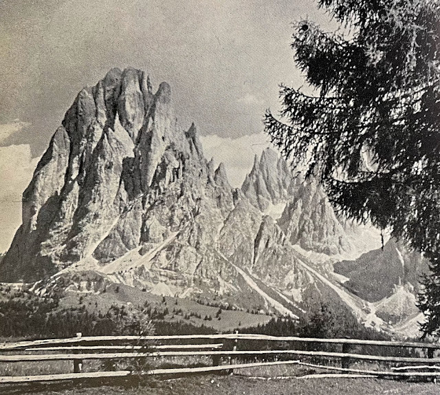
But first, what about the first photo from the late 70’s: it was in a geology textbook, showing the obviously deformed nature of the sedimentary rocks in the Italian Alps (which, by the way, I had never seen or seen before). visited Having never climbed the Alps, I had a big gap in my geology career. In 1985, I bought a second-hand copy of a book called “The Dolomites” by C. Douglas Milner. The book was published in England in 1951. Milner was a mountaineer, and many English people were aiming to climb the Alps at that time. DolomitiApparently I am still walking this (to me) elusive mountain path.
 |
|
Image from Milner’s book. Seeing this kind of scenery made me want to visit the Dolomites someday.. |
Our trip included a nine-day trek of over 85 miles through rugged mountains and on poorly maintained roads (personal assessment after the hike). But going that far requires extra time to accommodate time zone changes, prepare for delayed (or lost) gear, and visit other fascinating places nearby. So we traveled to and from Munich, Germany, with stops in Innsbruck, Austria, and Bolzano, Italy.
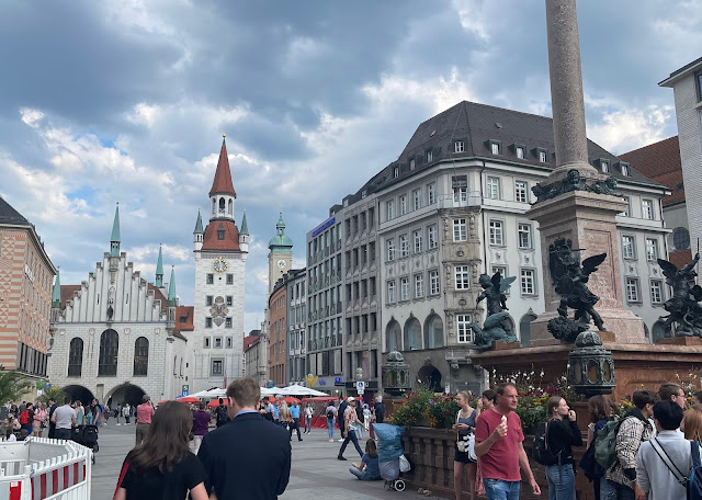 |
| Marienplatz in Munich city center |
We arrived in Munich on time in the early afternoon, checked into our hotel, and stayed up until Munich bedtime to get into the time zone. We were conveniently located in the city center and walked to Marienplatz (translation: Mary’s Square). The old world style buildings always fascinate us Americans, as does WWII history, and Munich has a lot of that history (although we didn’t take part in much of it, except for a very interesting and very reflective visit to Dachau, the first concentration camp).
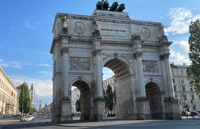 |
| The Sigester Tor on the north side of Munich, built in 1852 by order of King Ludwig I. |
We had a lot of fun in Munich – full of history and Helen was able to revisit the famous Hofbräuhaus which she had visited as a child in 1970. We spent two nights here and enjoyed it very much. However, we still couldn’t see the mountains so it was time to head south. But that would soon change.
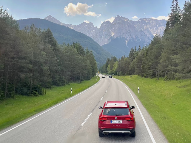 |
| Southwest road towards Garmisch-Partenkirchen, Germany |
We booked Flix public transport on a double decker bus. We found out that we could book before the trip and reserve specific seats. So we booked two seats at the very front on the upper deck with a big windscreen, where we could look out and take in the expansive views. About an hour from Munich, we got our first glimpse of the Alps. In Garmisch-Partenkirchen, an attendant came on board the bus and earnestly checked the passports of everyone on the bus. The driver was furious that this would delay us getting to Innsbruck.
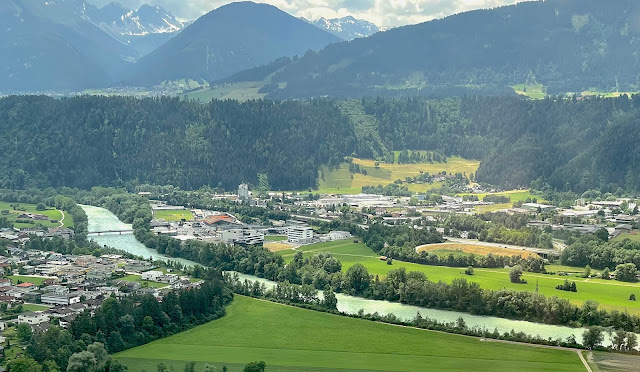 |
| Inn River in Suhl, Austria |
As soon as we crossed the German-Austrian border the road began a steep descent into the Inn River valley. It was spectacular. The river originates further west in Switzerland and flows east towards the Danube. All throughout the Inn Valley there are very noticeable plateaus which a quick internet search suggested could be of Pleistocene age. The plateaus can be seen in the photo above. 10,000 years of sculpting by the Inn River could have shaped the topography here.
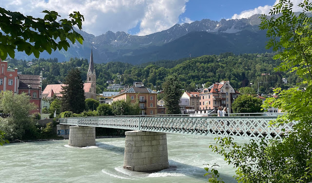 |
| Pedestrian bridge in Innsbruck’s city center |
I enjoyed walking around the old town center of Innsbruck (the name means “bridge over the Inn”). We walked everywhere, including the old tower. We climbed the 159 steps for a great view of the city. Public transport is easy and cheap. In fact, most hotels in the Tyrolean Alps give their guests a card to use public transport for free. During our stay in Innsbruck, we participated in a guest survey asking how we paid for it (not implemented here yet). However, during our stay in Italy, our hotel host gave us these cards freely. Even including a mountain gondola ride, which is considered public transport. All very civilized, modern and sensible. Another thing I noticed on this trip is that many of the founding dates of these cities were around the mid-12th century. Munich, Innsbruck, Bolzano, they all seem to have been founded around that time. It makes me wonder if the Medieval Warm Period facilitated the expansion of humanity around that time. An interesting thought.
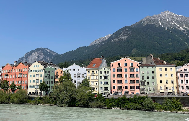 |
| Colorful buildings along the north bank of the Inn River in Innsbruck |
During WWII, 60% of the city’s buildings were destroyed, but the building in the photo above looks relatively new. You can read a bit more about the bombing of Innsbruck here. It’s sad to think about it, as the atmosphere was completely different and there were gelato shops everywhere. We were still new to the foreign land so we didn’t go too far from the city center, but there was plenty to see. But the gondola rides look like a good destination for our next trip.
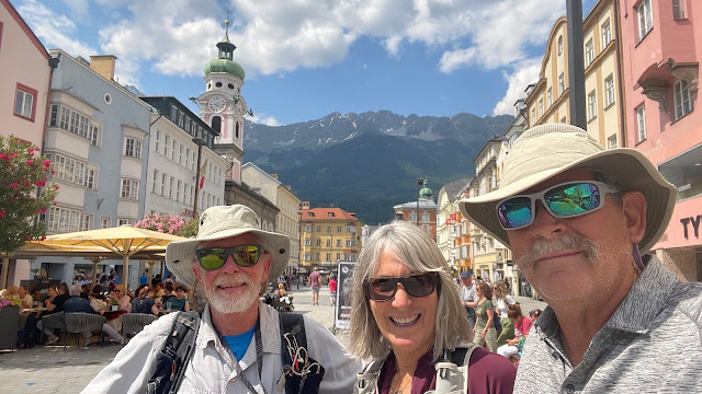 |
| Arizona vs Austria |
While in Innsbruck, I ran into my good friend Bill. His wife is of German descent and he comes to Germany often to visit family. It was a short train ride for him from Garmisch-Partenkirchen to Innsbruck.
 |
| View of the Dolomites from Mongelfo, Italy |
Now begins a gruelling nine-day journey through the mountains, but the rewards are great and well worth the effort.