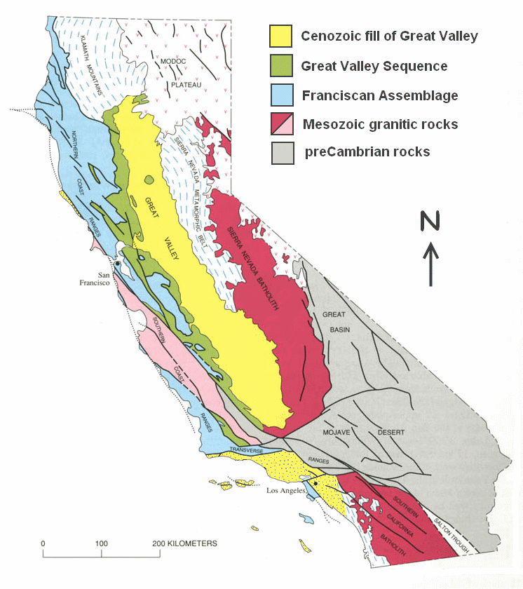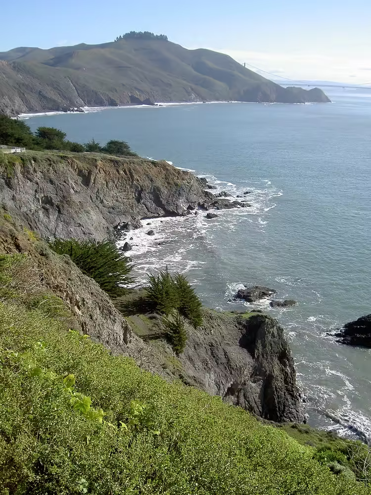
If you live along the Central and Northern California coast, you are likely living atop the California Coast Ranges and the Franciscan Complex. The Franciscan Complex is a chaotic mixture of rocks that began forming around the time dinosaurs walked the earth. What makes this rock complex so complex is the multitude of components and how they mixed violently together. This chaotic assemblage of rocks tells a 200 million year story of tectonic collisions, volcanic eruptions, the formation of the San Andreas Fault, and the uplift of the California Coast Ranges.

The mountains along the California coast are not the Himalayas, the Rockies, or even the Sierra Nevada. Those mountains do not reach as high an elevation, and their rocks are not as hard to resist wind and currents. This weak rock is ocean floor material that was deposited over millions of years and then rose above sea level to form the mountains and valleys along the California coast, from the Wine Country to the Central Valley.

The Francisco Complex records a long part of the Coast Range’s history, but it’s messy, with whole chapters missing. It’s like a book that’s been shredded, and only pieces can be pieced together. The formation of Francisco is actually pretty simple, but it created complexity. When the first dinosaurs walked on Earth, the oceanic Farallon Plate was moving eastward and diving under the continental North American Plate, forming a convergent boundary, or subduction zone. As the Farallon Plate subducted into a hotter, more pressured zone under North America, rock melted and became magma. The magma rose and erupted from volcanoes similar to modern Mount St. Helens and Mount Shasta. Periodically, the volcanoes exploded, raining ash on the land. Rivers carried some of the ash west toward the Pacific Ocean, where it settled on the ocean floor.

The ocean floor was deep beneath the waves, at the depths of an ocean trench that formed where the Farallon and North American plates met. Today, the trench, like the Mariana Trench, is 8-12 km deep and is the deepest part of the ocean. Carried to the trench by wind and rivers, volcanic ash mixed with rock debris and skeletons of sea creatures that had fallen to the deep ocean floor of the Panthalasic Ocean, the precursor to the Pacific Ocean.

At its westernmost edge, the oceanic Farallon Plate separated from the adjacent oceanic Pacific Plate. At this divergence boundary, magma rose to the surface and cooled to form the youngest edge of the oceanic plate. The earlier Pacific Plate grew larger as North America slowly moved toward it, and the Farallon Plate grew smaller as it subducted, melted, and provided fuel for volcanoes on the edge of North America.

In the trench of the Farallon-North America subduction zone, the top of the Farallon plate rubbed against the edge of North America, scraping off the loose rocks and sedimentary skeletons of the top of the plate. The scraped rocks folded and slid together, like scraping dough off the edge of a bowl with a spatula. It was a chaotic mess. Marine mud, skeletons of warm and cold water organisms, metals deposited during volcanic eruptions, chunks of ocean floor erupted at the divergence boundary, remnants of volcanic islands, sand and volcanic ash that were carried by rivers to the ocean and then washed into the trench. This deposition is called an accretionary wedge. Accretion is when small objects come together to form larger chunks, and these rocks are deposited in a wedge shape in the subduction trench. All these rocks mixed together as the Farallon plate subducted for over 150 million years, forming the Franciscan complex accretionary complex. Then, as the western edge of the Farallon Plate approached the trench, real chaos ensued.

As the Farallon Plate moved southeast, the diverging Pacific Plate moved northwest. About 30 million years ago, the first end of the Farallon Plate was fully subducted near present-day Los Angeles. The adjacent North American Plate was also moving northwest, but at a slower rate than the approaching Pacific Plate. As the two plates met, they began to slide against each other, forming a tectonic transform boundary that includes the San Andreas Fault. As the remaining parts of the Farallon Plate subducted under North America, the San Andreas transform boundary lengthened and stretched in a northwesterly direction. The sliding plates also pressed against each other, creating enough compression to form the Coast Mountains.

At least 315 km of landslides occurred over the course of 30 million years, and a series of mountains and valleys were formed as faults smeared rocks to the northwest and caused uneven uplift. This transition from subduction to transform boundaries caused plates to smear against each other and tear the edges apart. Huge faults formed, creating gaps in the crust through which magma rose and formed volcanoes. The volcanoes were torn in two, and the pieces were torn apart by the faults. These volcanic rocks are scattered throughout the Coast Ranges, including the Pinnacles Volcanic Field (Pinnacles National Park), Berkeley Hills, Sonoma Volcanic Rocks, and Clear Lake Volcanic Rocks, which all erupted from the uplifting Franciscan Complex and formed volcanoes on top of the accretionary wedge.

The San Andreas transform boundary continues to take shape beneath our feet. Clear Volcano, the northernmost of the transform boundary volcanoes, is still active. Konocti Mount will erupt again. Remnants of the Farallon Plate continue to subduct. The Juan de Fuca Plate to the north is the driving force behind the Cascadia Volcanic Arc. The Cocos Plate to the south is the driving force behind the Central American volcanoes. Tectonic boundary faults continue to move, mountains are uplifted, and rocks are being transported northwest.

The mountains of the Coast Range are simply rocks that rose higher than the valleys as the San Andreas transform boundary moved. The Franciscans underlie all the peaks and valleys of the Coast Ranges, and are exposed to the atmosphere and often scraped away by surface waters. Where the Franciscans are exposed at the surface, weaker rocks scraped away from the ocean floor break apart and are easily moved away by rivers. The mountains cannot rise to the height of the Sierra Nevada because the rocks are too weak. They are remnants of the ocean floor, and they rose when the subduction zone ended and a transform boundary formed in its place, and an accretionary wedge formed far below the waves came into contact with the atmosphere and became the mountains and valleys of the California coast. The ongoing story of the formation of the tectonic transform boundary and the Coast Ranges of California is only 30 million years old. Of course, there is more to the story. There always is. Each chapter took millions of years to record and decades to read, but humans are trying to tell a story they recently learned in just minutes or hours. It takes years to unravel a story this complex.


